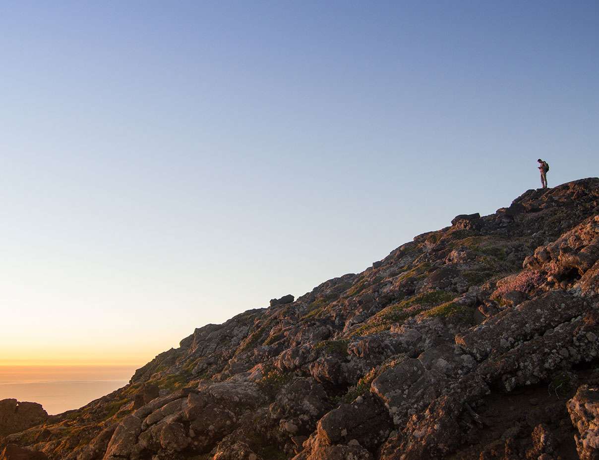
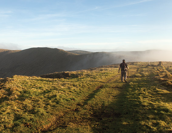
Pico mountain climb is a very special activity. For the Pico ascent, specific mountaineering techniques are not required to reach the peak. But it is a tough ascent and descent. And that’s why we only advice it for active people. People used to hike in natural terrain, or used to sports in general. Pico mountain is an unique kind of stratovolcano. Most of the lava flows that cover the cone are less of 5000 years old. It’s possible to observe a significant number of very well preserved pahoehoe lavas, and other volcanic features. The mountain flora is also unique in Pico. Calluna vulgaris and Daboecia azorica cover most of the mountain above 1500 meters. And the Silene uniflora cratericola is specific to Pico crater. And only exists there. Weather wise it’s also challenging. Since it can change very quickly. It’s important to be well equipped and prepared for rain, cold, wind and heat. Pico mountain climb is a very demanding activity.
Atividade: Hiking
“Caminho dos Burros” hike

The Caminho dos Burros hike begins in the heart of Pico’s central plateau, offering a perfect introduction to the island’s stunning landscapes. A 3-kilometer walk along a scenic road leads you to the famous Caminho dos Burros trail. This ancient path, originally built by our ancestors, remains well-preserved. The trail winds through the island’s rugged terrain, allowing you to experience the beauty of Pico island firsthand.
As you hike, you’ll encounter historical lava flows, formed during the eruption of 1562/64. These flows shaped the island’s volcanic landscape and tell the story of Pico’s fiery past. Along the trail, native flora thrives, showcasing the island’s biodiversity. The volcanic cones left by the eruption stand tall, offering a glimpse into the powerful forces that created Pico.
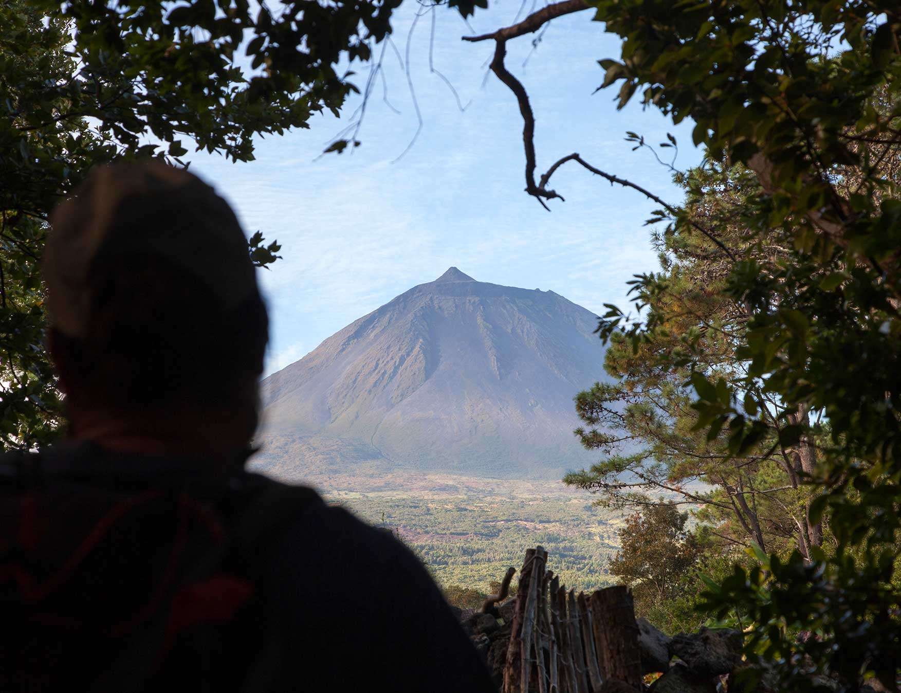
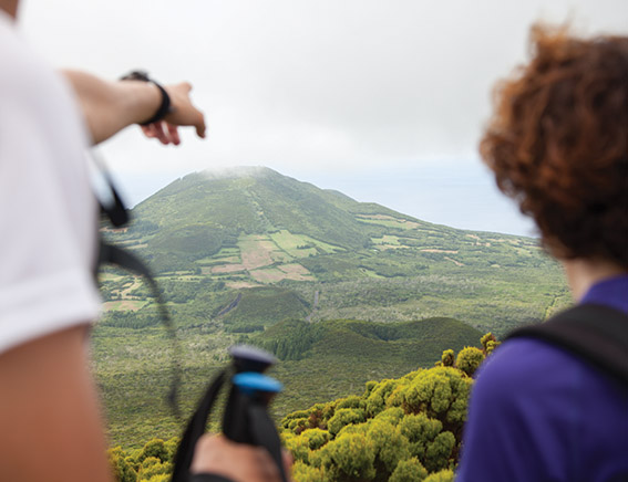
Hiking Along the Volcanoes of Pico
Pico is home to some of the most dramatic volcanic landscapes in the Azores. As you explore the Caminho dos Burros hike, you’ll walk alongside towering volcanic cones and craters that have shaped the island over centuries. The famous Pico Volcano, the highest peak in Portugal, dominates the landscape, reminding hikers of the island’s volcanic origins. These volcanoes played a major role in shaping Pico’s unique geology, influencing the terrain and the natural features that make the island so special.
A Refreshing End at Baía de Canas
The hike ends at Baía de Canas, a picturesque bay with crystal-clear waters. If the conditions are favorable, you’ll have the chance to cool off with a refreshing swim. This peaceful bay offers the perfect place to relax and unwind after your hike, surrounded by nature. The guide will ensure the pace is comfortable for all participants, so everyone can enjoy the adventure at their own level.
The Caminho dos Burros hike is a round trip, with all transportation between Faial Island and Pico Island included. Travel logistics are handled, making the entire experience seamless and stress-free.
Lajido Vineyards trail
Lajido Vineyards trail is an easy and historical hike in Pico. We can see and learn about the history behind Pico vineyards landscape. And to understand why it was considered UNESCO world heritage. A wine culture that started on the 16th century and saw its golden age and fall, both in the 19th century. The surrounding volcanic landscape, formed by recent Hawaiian type volcanic activity is also of great interest. It was organised and transformed by our laborious ancestors, so they could grow their vineyards and produce wine. So, we will also be able to better understand the formation of these pahoe-hoe lava flows as well as the erosion made by the ocean. Lajido Vineyards trail is an easy and cultural hike.
10 Volcanoes
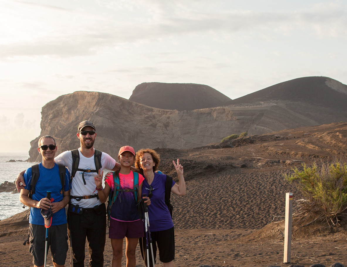
The 10 Volcanoes Trail is an unforgettable, full-day adventure that covers 21 kilometers, offering one of the most immersive hiking experiences on the island of Faial. This trail provides an exceptional opportunity to explore the diverse landscapes that make Faial a true gem of the Azores. As you embark on this hike, you’ll be captivated by the stunning scenery and the fascinating geological history of the island.
The 10 Volcanoes Trail takes you through some of the most iconic landmarks on Faial, including the Caldeira and the Capelinhos Volcano. These two points of interest are not only visually striking but also offer insights into the island’s volcanic past. Caldeira, a massive crater at the center of the island, showcases the raw power of nature, while Capelinhos offers a glimpse into the most recent volcanic eruption that reshaped the landscape in the 1950s.
Along the way, hikers will cross a variety of terrains, from lush forests to volcanic rock fields, providing a true taste of the island’s natural diversity. As we walk through the dense Azorean native forest, we’ll have the opportunity to learn about the endemic species that call this environment home. The island’s rich biodiversity and its geological significance are integral to the experience, making this trail a perfect blend of natural beauty and educational value.
Starting near Faial’s highest point, the trail gradually descends to sea level, providing breathtaking views throughout the journey. The 10 Volcanoes Trail is more than just a hike; it’s a deep dive into the volcanic origins and ecological richness of Faial. With every step, you’ll gain a better understanding of the island’s geology and history, making this a must-do experience for nature lovers and adventurers alike. At the end of the day, if the weather allows, it’s possible to take a refreshing swim in the sea, concluding the journey in an unforgettable way.
Caldeira Descent
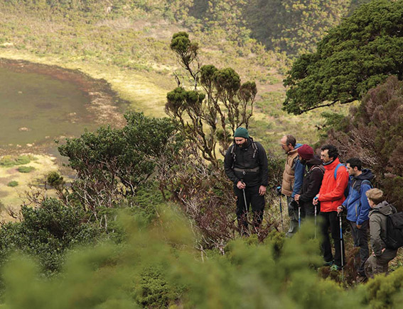
The Caldeira Descent offers one of the most unique and breathtaking hiking experiences in the Azores. The Caldeira of Faial, a volcanic collapse crater, has been a natural reserve since 1972 (category I – IUCN). This incredible landscape gives hikers a chance to explore the island’s volcanic past and its rich biodiversity. The Caldeira Descent allows hikers to venture deep into the heart of the crater, providing a rare opportunity to experience the stunning beauty of the area from the bottom of this massive volcanic structure.
Since the Caldeira of Faial is a protected area, Faial Natural Park controls access to the bottom of the crater, issuing a limited number of permits for the Caldeira Descent. This control helps preserve the environment for future generations. Because of the challenging nature of the descent, hikers must have a certified guide. These guides offer important insights into the geology, history, and ecology of the Caldeira, making the hike both physically rewarding and educational.
The Caldeira of Faial serves as one of the last strongholds for the Azores native forest, home to more than 60% of the region’s endemic species. It provides a glimpse of the Azores before human settlement. The descent itself proves difficult due to its narrow and steep terrain. In some areas, hikers need to scramble to navigate the trail. The unique biodiversity of the Caldeira consists of various humid habitats, which can often cause muddy or flooded areas at the bottom of the crater. These conditions add to the challenge of the Caldeira Descent, but they make the experience even more rewarding for those up for the adventure.
The journey into the Caldeira offers a truly special experience, connecting hikers to the untouched beauty of the Azores.
Around Caldeira
The Caldeira Perimeter trail is the highest hiking route on Faial, offering stunning views and a unique perspective on the island’s volcanic landscape. This trail circles the Caldeira, a volcanic collapse crater, providing hikers with an opportunity to explore the island’s geological history up close. The high altitude allows for sweeping panoramic vistas, where the landscape tells the story of Faial’s volcanic origins. As you walk along the rim, you’ll gain insight into how the island’s dramatic geology has shaped the environment we see today.
The interior of the Caldeira is one of the most important nature preservation areas in the Azores. The Caldeira is home to a variety of native flora, including species that have adapted to survive in the harsh conditions, such as the strong winds that frequently sweep across the area. This makes the trail an excellent opportunity for nature enthusiasts to learn about the unique plant life that thrives in this challenging environment.
Our Guides strongly recommend visiting the Caldeira Perimeter on a clear day, as rain and strong winds can make the trail more difficult and less enjoyable. However, when the weather is favorable, you’ll be rewarded with incredible views stretching across the island, offering nearly 360-degree panoramas of Faial’s stunning landscape. From the highest points, you can see the rugged coastline, neighboring islands, and the vast ocean beyond. The Caldeira Perimeter trail is a must-do for anyone interested in exploring the natural beauty and geological wonders of Faial, providing an unforgettable hiking experience.
Since this trail is at a high altitude, weather conditions may not always allow for it to be completed. If this occurs, we will suggest a coastal trail as a backup plan, which will also be enjoyable.
Full day Faial: Hiking & Culture
This tour perfectly combines nature and culture, offering you an exclusive way to discover Faial, accompanied by our certified Guide, in a private setting.
It will be an unforgettable day on the island of Faial, surrounded by nature. The day begins with a hike around Caldeira do Faial, an impressive volcanic crater offering panoramic views of the Triangle Islands. For about 3 hours, you’ll hike along the highest point of the island, surrounded by rich biodiversity. Our Guide will share knowledge about the local geology and flora. If the weather doesn’t allow this activity, we’ll opt for Praia do Norte Trail, an equally fascinating alternative.
After the hike, it’s time to relax and taste the delicious Azorean cuisine. We’ll head to the Cedros village , where you’ll have the opportunity to enjoy lunch at a traditional local restaurant.
In the afternoon, the tour continues by car, exploring more of Faial’s unique landscapes. We’ll pass through Fajã da Praia do Norte, a unique and peaceful spot where you can appreciate its beauty and culture, and if the weather permits, take a swim in the ocean. To end the day, we head to the Capelinhos Volcano, an area marked by the island’s most recent eruption, which occurred between 1957-58. This event dramatically transformed the local landscape, and our Guide will share the history and details of this eruption that shaped the island as we know it today.
Natural-pool hopping
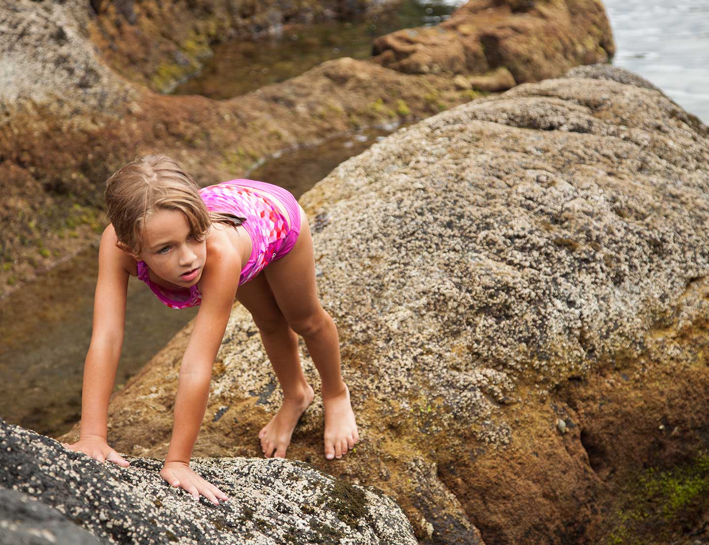
This is an ideal full day tour for families with kids during the Summer time. You will be able to have fun and acquire more knowledge about the places we visit in a different way, since this tour is a slow walk through unique pleasant landscapes.
During the morning we can swim and snorkel in 3 natural tidal pools. Most of the walk is at the sea side of São João Civil Parish and we can appreciate a number of cultural features. From the popular architecture to the beautiful fruit and food gardens. We will also see and learn about the Historic eruption of 1718, when lava flows destroyed part of the parish.
We can also taste at lunch the delicious local gastronomy that combines new cooking techniques with the traditional flavors of the Azores. At afternoon we will be able to relax and enjoy the pleasant feelings that nature transmits. Spending time in nature and swimming in the ocean is always a good idea for the whole family!
Here is a video about it on our blog.